


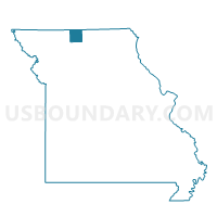
Madison Voting District, Mercer County, Missouri
About
Outline

Summary
| Unique Area Identifier | 609102 |
| Name | Madison Voting District |
| County | Mercer County |
| State | Missouri |
| Area (square miles) | 41.39 |
| Land Area (square miles) | 41.38 |
| Water Area (square miles) | 0.01 |
| % of Land Area | 99.98 |
| % of Water Area | 0.02 |
| Latitude of the Internal Point | 40.31322030 |
| Longtitude of the Internal Point | -93.72421640 |
Maps


Graphs
Select a template below for downloading or customizing gragh for Madison Voting District, Mercer County, Missouri


Neighbors
Neighoring Voting District (by Name) Neighboring Voting District on the Map
- Franklin Voting District, Grundy County, MO
- Harrison Voting District, Mercer County, MO
- Mt. Moriah Voting District, Harrison County, MO
- Washington Voting District, Mercer County, MO
- Washington Voting District, Grundy County, MO
Top 10 Neighboring County Subdivision (by Population) Neighboring County Subdivision on the Map
- Franklin township, Grundy County, MO (485)
- Washington township, Mercer County, MO (411)
- Madison township, Mercer County, MO (232)
- Harrison township, Mercer County, MO (226)
- Trail Creek township, Harrison County, MO (216)
- Washington township, Grundy County, MO (114)
- Fox Creek township, Harrison County, MO (105)
Top 10 Neighboring Elementary School District (by Population) Neighboring Elementary School District on the Map
Top 10 Neighboring Unified School District (by Population) Neighboring Unified School District on the Map
- Trenton R-IX School District, MO (7,824)
- South Harrison School District, MO (5,688)
- Princeton R-V School District, MO (2,633)
Top 10 Neighboring State Legislative District Lower Chamber (by Population) Neighboring State Legislative District Lower Chamber on the Map
Top 10 Neighboring State Legislative District Upper Chamber (by Population) Neighboring State Legislative District Upper Chamber on the Map
Top 10 Neighboring 111th Congressional District (by Population) Neighboring 111th Congressional District on the Map
Top 10 Neighboring Census Tract (by Population) Neighboring Census Tract on the Map
- Census Tract 9501, Harrison County, MO (3,483)
- Census Tract 4702, Mercer County, MO (2,353)
- Census Tract 9602, Grundy County, MO (2,086)